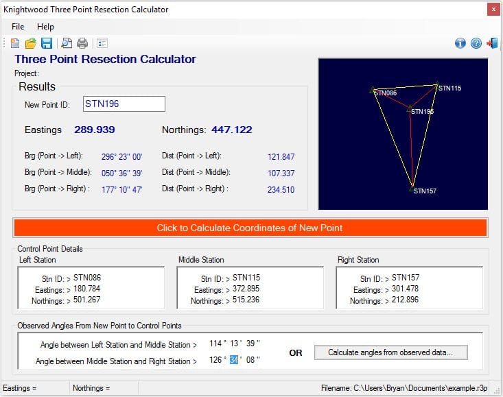
This free land surveying software is designed for use by land surveyors, engineers and archaeologists. This program carries out the calculation for a three point resection. This land surveying technique enables the position of a point (Eastings, Northings) to be found by observing angles at that point between three other points of known coordinates. The only limitation is that the three known points must not lie on a straight line but form a triangle. The point to be found can lie either inside or outside this triangle.
Just enter into the program the coordinates of the Left, Middle and Right known points, and the angles measured at the unknown point between the Left and Middle point, and the Middle and Right point. The coordinates of the unknown point are then calculated and displayed.
A major advantage of this method is that no distance measurements are required so can be performed with a basic theodolite. This free version is fully functional and includes the option to purchase a license which will activate the additional feature of being able to enter angles as rounds of observations.
Comments not found