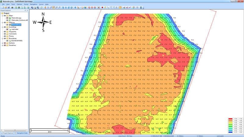
Hydrographic Survey Software for Windows, Load topographic or nautical maps, create singlebeam soundings, generate DTM's (Digital Terrain Models), generate depth contours, generate cross-sections, volume calculations and more. The software can be used with various map formats including: GeoTIFF, Microstation DGN, ARC/INFO, MapInfo MIF/MID, AutoCad DXF files, IHO S57/S63 Electronic Natutical Charts and ESRI shapefiles.
. Since this latest version, the software can be used to collect and process dual frequency sounding data, as well as additional sensor data, such as magnetometer data, or advanced data from echosounders, like reflectivity or bottom-loss.
Another big improvement is the use of shorelines. Shorelines can be used to add data collected near the shore, to create islands or to clip your DTM data, by just by specifying on which side of the shoreline the water is.
Comments not found