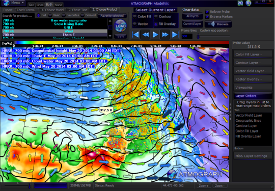
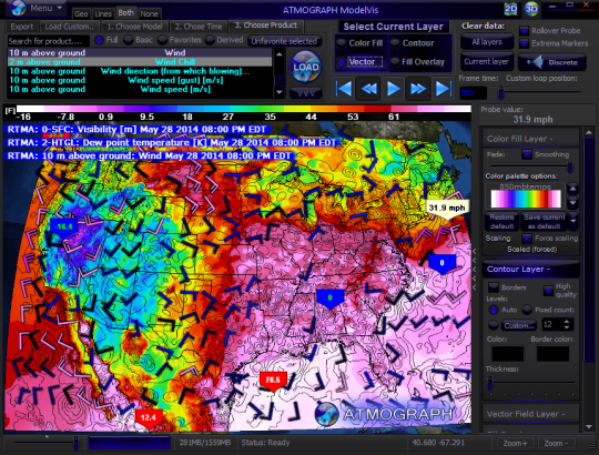
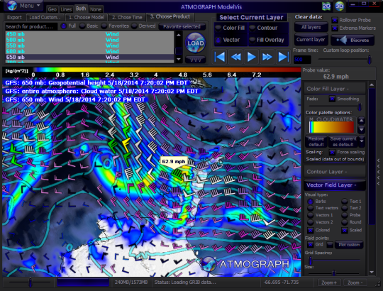
ATMOGRAPH is advanced weather model data visualization and analysis software for meteorologists, storm chasers, aviators, forecasters, and enthusiasts alike, allowing users to import custom GRIB data and choose from a built-in list of weather models including the GFS, NAM, HRRR, HRW, RAP, NAVGEM, and many more.
Users can display/animate the FULL-RESOLUTION model data grids on a hardware accelerated, interactive, 3D globe instead of seeing overly-smoothed, low-resolution online images. AtmoGraph allows users to obtain weather model data straight from the original government sources as soon as they are uploaded, instead of waiting up to an hour for online image services. AtmoGraph's dynamic, fast-rendering, zoomable 3D globe can be converted to a 2D flat map and back at the touch of a button.
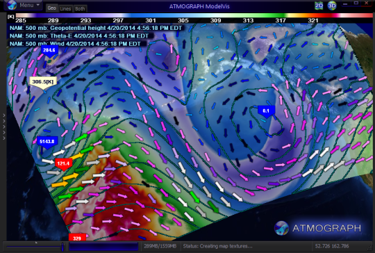
AtmoGraph uses patent-pending technology to display time-interpolated model data animations with either color fill, vector field, or contour line layers. Users can rollover the mouse to any point on a grid and see a live display of data value at that exact point.
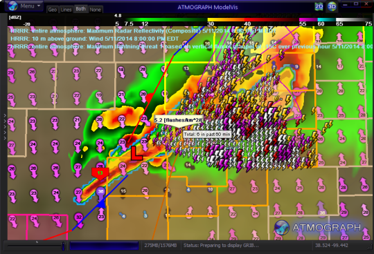
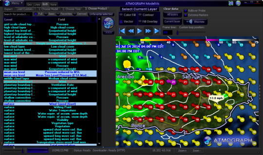
AtmoGraph enables the user to explore the FULL SET of products from a particular model, which is typically hundreds of various layers describing different atmospheric parameters at different levels of the atmosphere. A "basic-only" filter feature can limit this list to only the most essential model data products (surface wind/temperature/CAPE/dew point, upper level winds, precipitation, future radar reflectivity).
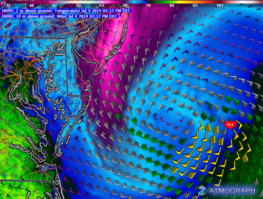
ATMOGRAPH can access the unreleased High-Resolution 1km HRRR model, which delivers weather forecast imagery of stunning resolution for the United States. No other interactive weather graphics display software in the world can currently display this experimental, unreleased model without an expensive subscription.
Users can import their own model data grids in GRIB format, allowing the software to be used in any scientific, maritime, research, or hobbyist context. Additionally, AtmoGraph supports the popular Placefile data format for displaying general weather data.
A competent GIS viewer itself, AtmoGraph can also import and display ESRI Shapefile data with custom user styling options. Built-in high resolution background imagery allows users to zoom in and see crystal-clear background map satellite images even down to the street level.
Limitations:
14-day trial


Comments not found