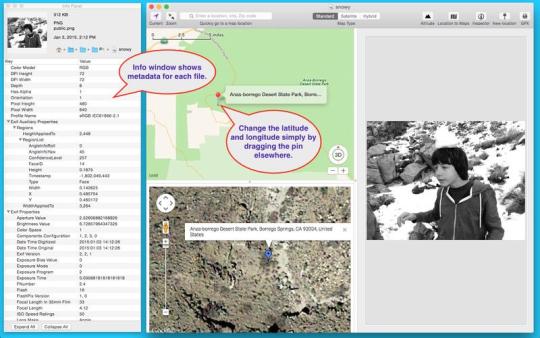
Photo GeoTag allows you to geotag JPEG, PNG and TIFF files, or change the existing geotag information. It's a great way to add or correct the GPS properties of any JPEG, PNG or TIFF file! Have a lot of photos with no GPS values? Now you can easily geotag them. Have photos with an incorrect GPS location? Now you can easily correct the GPS location.
When you open a JPEG, PNG or TIFF image file with Photo GeoTag, the image and a map are displayed on a single window. If the image has GPS properties, a map pin is placed on the map representing the GPS location. To change the latitude and longitude GPS properties, simply drag the map pin to a new location. To add the latitude and longitude GPS properties, either specify the address, or the latitude and longitude values, or simply shift-click the map and a pin is dropped on the location you clicked. It's that easy! To update the altitude, click the altitude button. No changes are made to the file until you save your changes.
A batch mode is also available for assigning multiple files with the same location.
What is new in this release:
- Export map screenshot
- Export file metadata as a tab-delimited file
- Display satellite view and street view (if available) of map pin location
- Bug fixes to the metadata display panel
- Other bug fixes and other user enhancements
Comments not found