Software Screenshot:
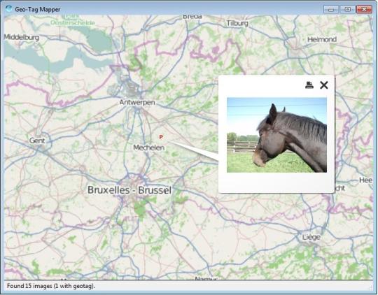
Geo-Tag Mapper shows geo-tagged images on a virtual globe. Geo-Tag Mapper scans a selected directory and it's subdirectories for image files and checks if they have a geo-tag. If so, they are plotted on a virtual globe so you can see where the pictures were taken and preview them.
What is new in this release:
Version 1.1 fixed coordinate sign bug.
Comments not found