Software Screenshot:
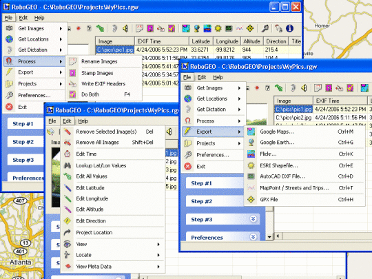
Geocode photos with latitude, longitude, and altitude information. Stamp the images or write (lossless) to the EXIF headers. Create web pages using Google Maps, export KML or KMZ files to Google Earth, upload to Flickr, or export shapefiles (SHP) or AutoCAD DXF files. Supports Garmin GPS units (USB or COM), but no GPS is required. Geotag from a GPS tracklog, waypoints or a GPX file. Internationally aware, Easy to use, and free lifetime upgrades.
What is new in this release:
Version 6.3.1 has added the ability to export HTML.
Limitations:
Inaccurate values trial
Comments not found