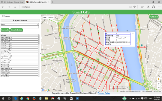
GIS Software Elshayal Smart GIS 16007d to Convert Shape file to HTML GIS Web and Mobile Open Source
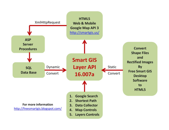
Free Arab GIS and GPS Software which is completely developed by Arabian programmers and independent of any commercial software package, It is not supported or funded by any organization, and it consists of Map Editor for desktop, Map Server for web application, Mobile GPS Tracking for mobile devices, Free Open Source Code Library 16.007d to Convert Shape files to HTML5 GIS Web and Mobile Application, and Free Download
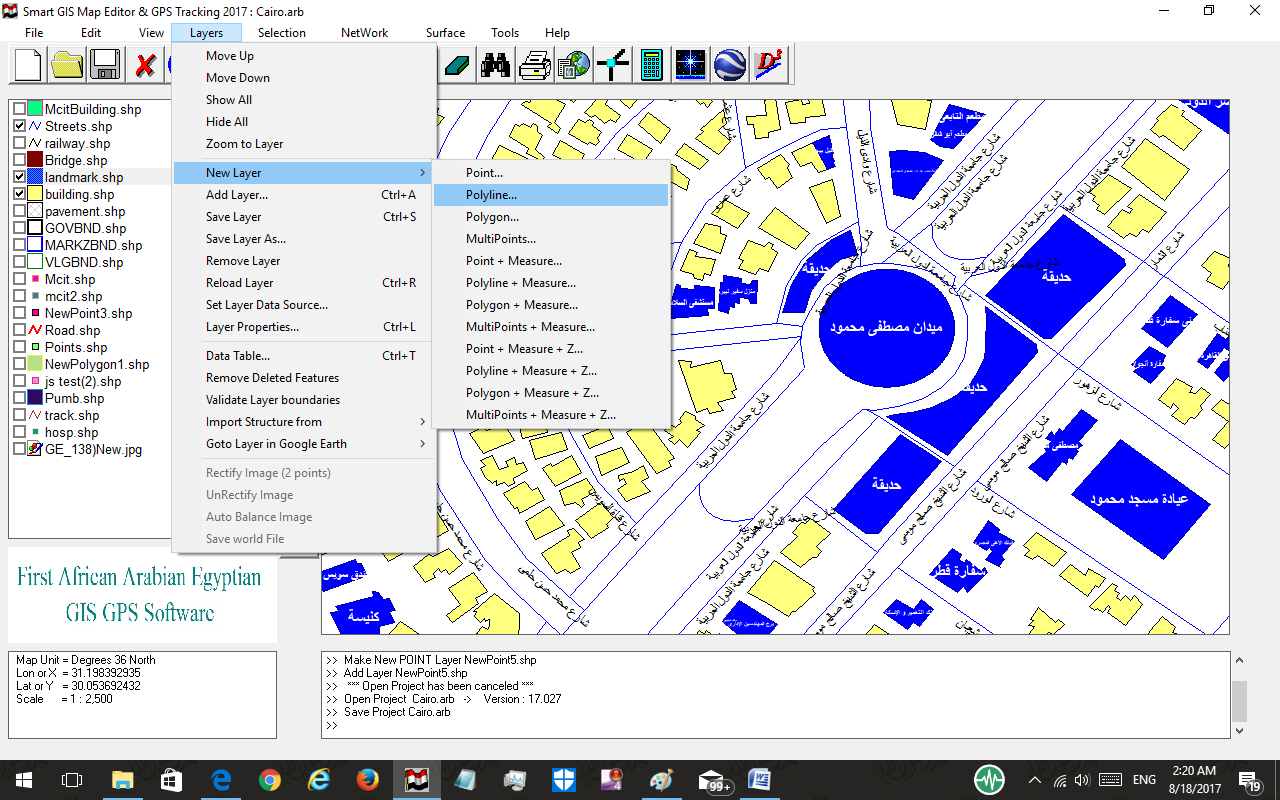
1. First Arabian GPS and GIS Software - Registered in 2005 2. Digitize and Analysis (Spatial, Attribute, Surface) GIS Data 3. Build, edit and view shape files and related dbf files 4. Download Google Earth rectified maps and rectify raster images 5. Convert shape files to AutoCad dxf format 6. Convert shape files and rectified images to html5 web site and Mobile Application 7. Areas and surfaces and networking analysis 8. Online GPS Tracking System 9. Free for None Commercial Use 10. Independent of any Software Package, or Code Library 11. Built by Individuals and Not Supported by any Organization
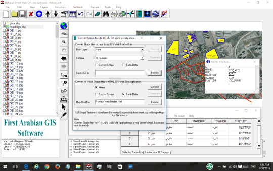
This software contain a GIS Programming Course Syllabus for learning how to convert GIS shape files to HTML Web and mobile application.
Part 1 (GIS Theoretical) Part 2 (HTML5 & CSS and JS Programming) Part 3 (Google Map API Programming) Part 4 (Building GIS Web Based Application) Part 5 (Server Data Base Programming by ASP) Part 6 (Building GIS Web Based Mobile Application)
In this course the trainees will learn by using Smart GIS ready made code library and template :- 1 - How to convert GIS shape file layer to HTML5 and Google map api file format 2 - How to deal with GIS shap file Layer in Google map api 3 - How to build HTML5 + Java Script + CSS web application 4 - How to connect database and retrieve results 5 - How to use ASP to connect Database and retrieve data and draw it in the Google map api 6 - How to use all of the above mentioned skills to build a mobile application
What is new in this release:
Version 16.007d include this new function :- Convert shape files and rectified images to html5 web site and Mobile Application.
Comments not found