Software Screenshot:
Software Details:
Version: 8.5.6
Upload Date: 2 Jan 15
Developer: Interstudio S.r.l.
Distribution Type: Shareware
Price: 170.00 $
Downloads: 50
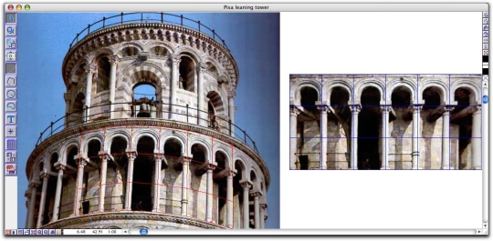
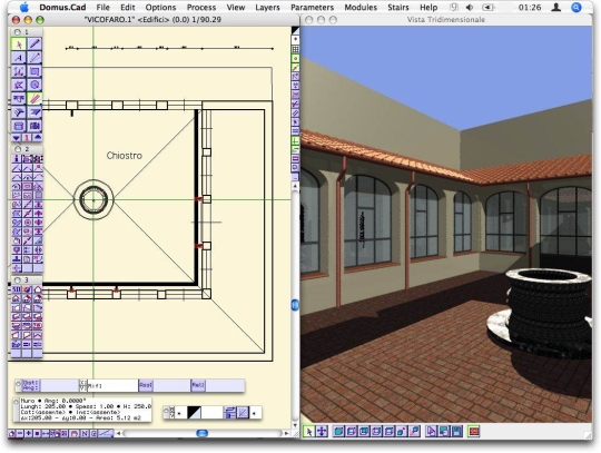
DigiCad 3D is an excellent tool for dealing with images, drawings, photographs of building facades and maps. It operates either directly on raster images or by digitization.
DigiCad 3D is used in photogrammetry, cartography and, increasingly in recent years, in architectural photogrammetry, for which it offers powerful, easy-to-use and exclusive instruments, like elimination of optical deformation, elimination of perspective distortion from flat and curved surfaces, mosaics, correction and geo-referencing of maps, straightening up curved surfaces, transparency control and others.
What is new in this release:
A short list of some of the new features and improvements (see the Release notes for more information):
- More precision with large images
- Some bugs fixed
Limitations:
30-day trial

Comments not found