Software Screenshot:
Software Details:
Version: 1.35
Upload Date: 2 Nov 15
Developer: TopoFusion
Distribution Type: Shareware
Price: 40.00 $
Downloads: 6
Size: 6243 Kb
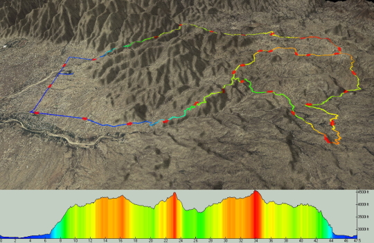
From the developer: TopoFusion is a Windows application that maps GPS data on Topo and Aerial maps for the United States. It was designed from the ground up to display Terraserver image data as quickly as possible. It reads and writes the GPX format as its primary file format. TopoFusion supports all Garmin and Magellan GPS units. Other features include placement of digital photos using EXIF headers and advanced GPS track processing (trail networks, splining).
Requirements:
Windows 95/98/Me/2000/XP, DirectX 7.0
Limitations:
See description
Comments not found