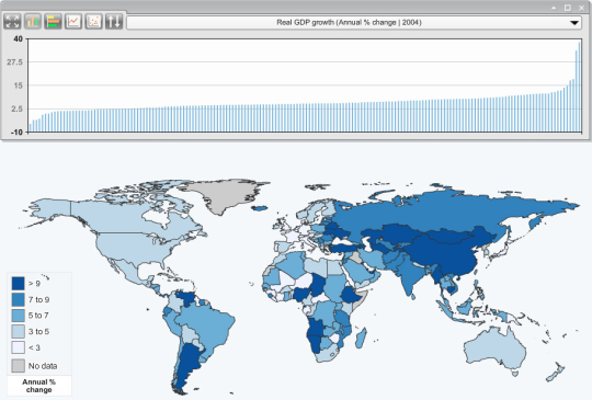
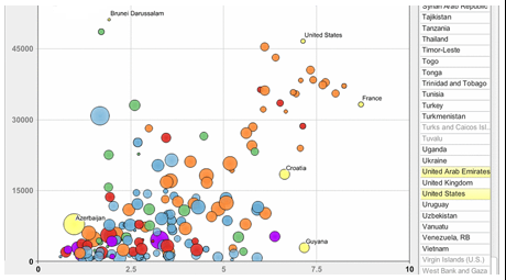
StatPlanet is a free award-winning* application for creating fully customizable interactive maps and graphs, with both online and desktop versions. Data can be imported automatically, so new interactive maps can be created within minutes. Maps are completely customizable. Use the included World or USA maps, design your own maps using the Flash template, or load ESRI shapefiles using StatPlanet Plus. StatPlanet can be used to create simple thematic maps as well as more advanced interactive infographics with different graph & chart options, multiple indicators, and a time slider with the option to animate both the map and the graph over time. Supported map types are quantitative choropleth maps, qualititative (descriptive) maps and proportional symbol maps. All map and interface colors can be customized. The included Excel-based data editor can be used to automatically import data from virtually any data source. No programming knowledge is required.
What is new in this release:
- New improved interface
- Support for categorical (qualitative/descriptive) maps
- Many new customization options
- South Sudan and Kosovo added to World Map edition
Comments not found