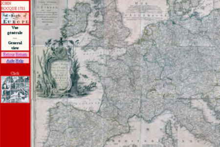
Travel through the major European roads in the XVIIIth century, for all operating systems. A map of European Post-Roads by John Rocque 1752, reprinted in 1781. Documents provided in .jpg mode images and presented on html pages readable with a Web browser. - 24 images of 1912 x 2695 px x 72 dpi, each representing one of the 24 original sheets in real size. 24 images of 690 x 982 px x 72 dpi, each representing one of the 24 originals in reduced size. 288 images of 708 x 749 px x 72 dpi constituting real size sections of the main map, to facilitate spatial navigation. Map viewable in all operating systems. Web browser required but Internet connection not necessary. The original map as well as the presentation pages are fully bilingual: English and French. It is possible to edit the pictures with an imaging software. The trial version is limited to some details of the general map.
Limitations:
Limited to some details only of the general map
Comments not found