Software Screenshot:
Software Details:
Version: 1.0
Upload Date: 6 Feb 16
Developer: Knightwood Land Surveying Software Utilities
Distribution Type: Shareware
Price: 57.00 $
Downloads: 8
Size: 238 Kb
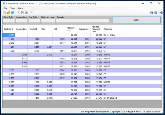
Designed for use by land surveyors, engineers and archaeologists this program mimics the layout of a standard rise/fall level book used when determining the difference in height above sea level between one or more points. Enter your observations and Knightwood LevelBook will automatically calculate Rise/Fall and Reduced Levels, misclosure and adjustment values from your observed backsights, intermediate sights and foresights. Results can then be printed out or saved for future reference.
Using this program eliminates many tedious calculations and the potential for errors that can arise. Results can then be output in a presentable fashion and saved digitally.
Limitations:
Some features disabled


Comments not found