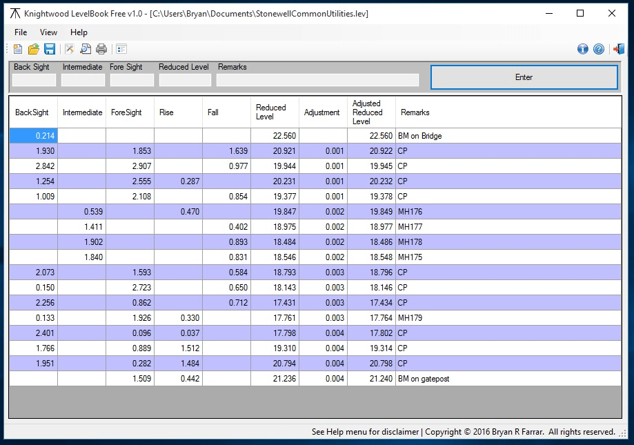
Designed for use by land surveyors, engineers and archaeologists this program mimics the layout of a standard rise/fall level book used when determining the difference in height above sea level between one or more points. Enter your observations and Knightwood LevelBook will automatically calculate Rise/Fall and Reduced Levels, misclosure and adjustment values from your observed backsights, intermediate sights and foresights. Results can then be printed out or saved for future reference.
This version is fully functional but is intended for evaluation purposes only. If, after evaluation, you intend to continue to use the software then please upgrade to the Pro version, which adds the ability to personalise printouts with logo/contact details.
Using this program eliminates many tedious calculations and the potential for errors that can arise. Results can then be output in a presentable fashion and saved digitally.
Comments not found