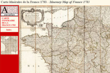
This is a digital copy of the Itinerary Map of France 1783 which shows the road network as it was in the 18th and 17th centuries. The provinces of the Ancien Regime are clearly legible. A town index allows a fast and direct acces to the requested places and a short chronology marks the main events of French history in the 18th century. Main Features: 35 scanned JPG format map sheets showing France in 1783. France 1783 is presented on HTML pages allowing an easy and fast navigation. Size of each map sheet: 1666 x 2342 pixels x 295 dpi. 210 real size sections of the main map, 833 x 780 pixels x 295 dpi each. Real size of the whole map, same as the original: ~100 cm x ~100 cm. Bilingual index with ~950 places in France and adjacent countries.
Limitations:
Limited functionality
Comments not found