Software Screenshot:
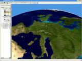
Earth3D is a program that visualizes the earth in a realtime 3D view. It uses data from NASA,USGS, the CIA and the city of OsnabrA¼ck. You can view the earth as a whole and zoom in until countries, cities and even single houses become visible. It also features external data like current earthquake positions or cloud data.
Requirements:
Java
Comments not found