Software Screenshot:
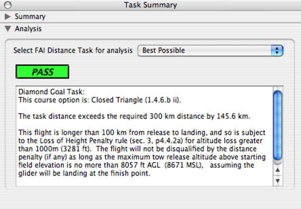
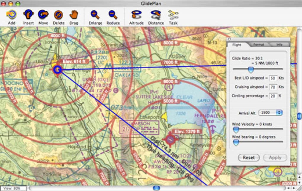
Glideplan allows the glider pilot to quickly plan and explore potential cross country flights from the desktop. It uses current Sectionals for the entire US, and creates graphic overlays similar to traditional map marking techniques. GlidePlan Produces automatic contoured lines of glide elevation for intuitive planning so pilots can easily explore impact of arrival altitude and glider performance on goals or tasks. It's great for instructors, and students learning cross country techniques. GlidePlan features Automatic evaluation of tasks for FAI badge compliance, with diagnostics, and outputs printed maps at Sectional scale, with automatic map legends, eliminating the need to mark up Sectionals by hand.
Requirements:
Mac OS X 10.3 or higher

Comments not found