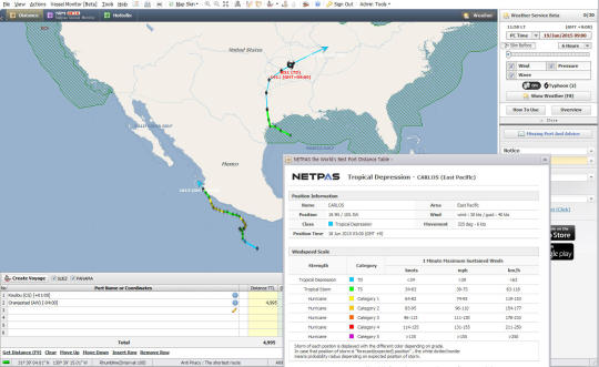
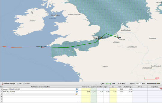
Netpas Distance is a port distance table supporting more than 12000 ports and 0.1Billion distance table. With Netpas Distance, you can get ports distance with checking the route on e-world map. You can edit your route with your own way and draw another route. Netpas Distance provides whole e-world map control including zooming in and out. Now you do not need to search port atlas book anymore. You can find out any port with just typing the port name in Netpas Distance. Netpas Distance is getting smart. Now, you can track your vessel and manager your voyage. It will show your real route on the map. Even you can calculate your simple voyage estimation. Also It support SECA, Piracy Zone, Sea Ice, Weather information and many powerful functions.
What is new in this release:
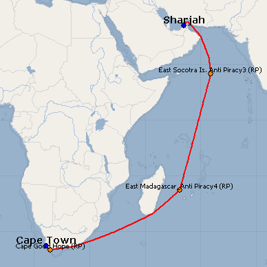
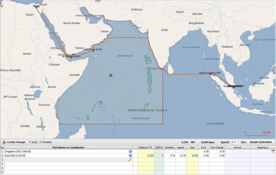
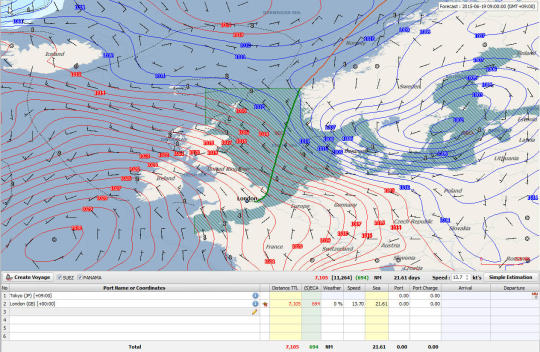
Version 3.3: ECA, Piracy Zone, Sea Ice. Weather Report.
Limitations:
Limited functionality, 5 times daily limit
Comments not found