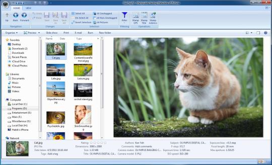
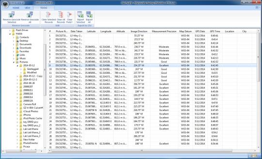
GeoTagEd allows you to view the most important location and GPS information of your digital photos (Jpeg and Tiff), which are embedded and can not be seen with most image viewers. You can easily add, edit or remove location and GPS information of your photos. With GeoTagEd, you can stamp the GPS information of your photos in a readable format on the pictures for easy access. You can reverse geocode GPS data and retrieve the name of the location, city, state/province, and country where the photo was taken, and save it in the picture, or stamp it on the pictures. All these functionalities are provided with a user friendly interface. You can do it on a single picture or a bunch of pictures with few mouse clicks. The original pictures could be overwritten or remain un-changed. You can easily browse your file system and edit any picture you want. It can reliably reveal all location information and allows adding/editing and removing geotag metadata.
Limitations:
10-day trial
Comments not found