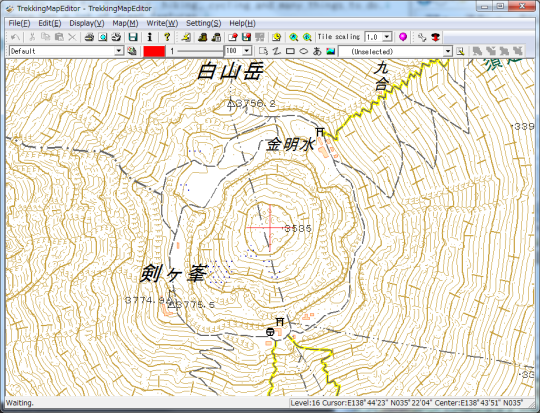
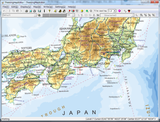
Software Screenshot:
Software Details:
Version: 1.23
Upload Date: 19 Sep 15
Developer: The Internet Man
Distribution Type: Shareware
Price: 9.99 $
Downloads: 100
Size: 10297 Kb
TrekkingMapEditor is GSI(Geospatial Information Authority of Japan) map viewer, and also print it. This map can be used for trekking, hiking, cycling and many things to do. This software has a lot of great features. * Zoom and scroll by the mouse. * To print the map is very easy. * Print out fit the paper. * High speed download Map tiles . * Magnetic line auto writing. * Latitude/Longitude line auto writing. * Distance line auto writing. * Scale line, Addtional line. * Customizable. * Print out with scale. * Color change. * Multi paper print out. * Can write rectangle, ellipse, string, picture. * Print history.
Many mountain climbers use this software in Japan.
Limitations:
Print out 3 times

Comments not found