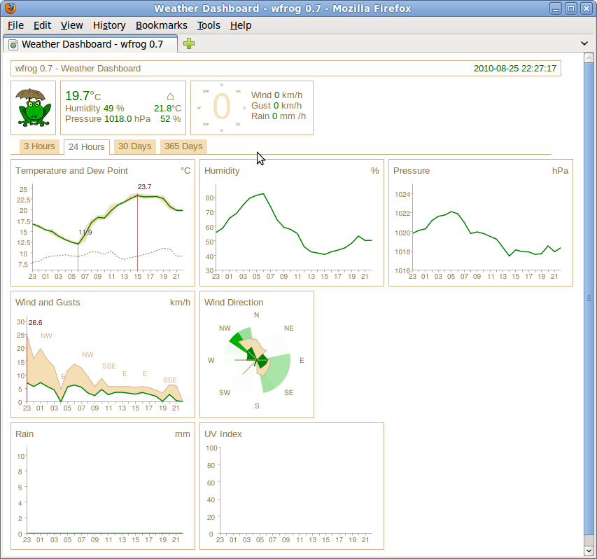
Software Screenshot:
Software Details:
Version: 1.4.0
Upload Date: 17 Feb 15
Developer: Jody Garnett
Distribution Type: Freeware
Downloads: 74
uDig is an open source, multiplatform, free and user-friendly graphical application built with the latest and greatest Java/Eclipse technologies, designed to provide a spatial data viewer and editor with special emphasis on the OpenGIS standard.
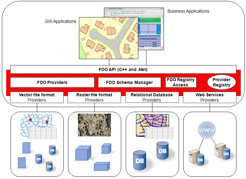
Supports Internet GIS and Web Feature Server standards
The software has been designed from the offset to support Internet GIS (Geographic Information System), Web Feature Server standards, as well as the Web Map Server. In addition, it provides a common Java platform that can be used to build spatial applications, which can contain open source components.Runs as a standalone app and can be easily extended
uDig can be used as a standalone application and requires no installation, just make sure that you have the latest JRE (Java Runtime Environment) installed. The software can be easily extended through RCP plugins and it can also be used as a plugin in an existing RCP (Rich Client Platform) application.It’s an Internet oriented application
Another interesting feature is that uDig is an Internet oriented application that consumes de facto and standard geospatial web services, including WMS, WPS, WFS, GeoRSS, tiles, and KML. Additionally, it provides a framework that lets you to easily build complex analytical capabilities.Getting started with uDig
To use the uDig application on your GNU/Linux operating system, you will have to download the pre-built binary package that corresponds to your computer’s architecture (32-bit or 64-bit) and the sample data, saving both archives on your Home directory.Unpack the archives, and start the application by double clicking on the udig.sh file from the ‘udig’ folder. Run the application. Then, drag and drop a file from the sample data folder into the uDig’s main panel.
Runs on Linux, Windows and Mac OS X
Being written in Java, uDig is a cross-platform application that runs on any computer operating system where the Java Runtime Environment (JRE) technology is available, including GNU/Linux, Mac OS X, and Microsoft Windows OSes. It supports 32 and 64-bit computers.What is new in this release:
- Bug:
- [UDIG-1537] - Ensure Libs has correct source jars for GeoTools to aid debuggin
- [UDIG-1596] - WMS GetCapabilities does not attempt to use version 1.3.0
- [UDIG-1866] - Printing prints black pages
- [UDIG-1935] - ProjectUIPlugin causes SWTException invalid thread access because of FeatureEditorExtensionProcessor
- [UDIG-1937] - NullPointerException on empty Layer and "View line orientation"
- [UDIG-1941] - Color Theming Error
- [UDIG-1945] - Eclipse General Wizards listed
- [UDIG-1948] - SDK does not resolve sources in net.refractions.udig.libs.source
- [UDIG-1952] - uDig License Change
- [UDIG-1958] - WMS GetFeatureInfo 1.3.0 Inconsistent Axis Order
- [UDIG-1960] - WMS 1.3.0 GetMap exceptions formats
- [UDIG-1967] - Problems in execution from Geoscript Console
- [UDIG-1968] - Image and PDF Export from Map is broken (An unexpected failure occurred: null)
- [UDIG-1976] - DnD into Layers view does not add Layer when Service already registered in Catalog
- [UDIG-2025] - PDF Image export wizard does not honor DPI setting
- Improvement:
- [UDIG-1504] - When all items in a category are disabled, the category should also be disabled
- [UDIG-1934] - Cache IResolveAdapterFactory target classes to improve Rendering Performance
- [UDIG-1938] - remove System.out.println() from bundle eu.udig.style.advanced
- [UDIG-1973] - Point layers are visualized always with grey squares instead of random colour
- New Feature:
- [UDIG-1923] - DocumentView and Hotlink Tool
- [UDIG-1947] - Standalone SDK target platform including Eclipse Sources
- [UDIG-1956] - Add Graticule Graphich to net.refractions.udig.mapgraphic
- [UDIG-1964] - RFC: Adding a Geoscript console to uDig
- Wish:
- [UDIG-1519] - Polyconic projection support
What is new in version 1.3.0:
- This point release includes new functionality and some great usability improvements, with a new tool palette and easy-to-access tool options.
Requirements:
- Oracle Java Standard Edition Runtime Environment
1 Comments
ผู้ใช้งาน 17 Aug 17
uDIG เป็นโปรแกรมของประเทศไรครับ