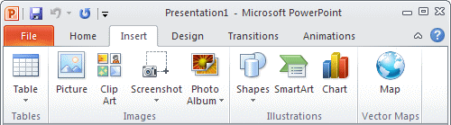
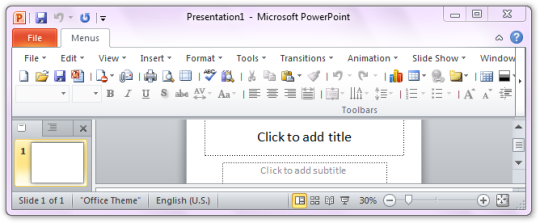
Easily insert and edit these maps in your PowerPoint slides. vMaps adds a new button to your PowerPoint ribbon which gives you access to more than 3000 vector drawn maps at a single click which can be edited, styled and animated as you need. These maps are designed in PowerPoint, for PowerPoint users.
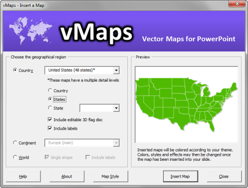
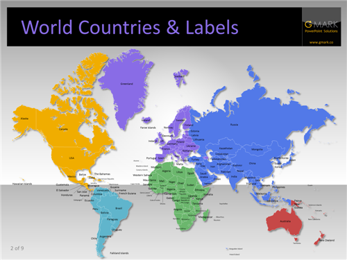
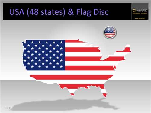
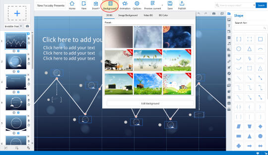
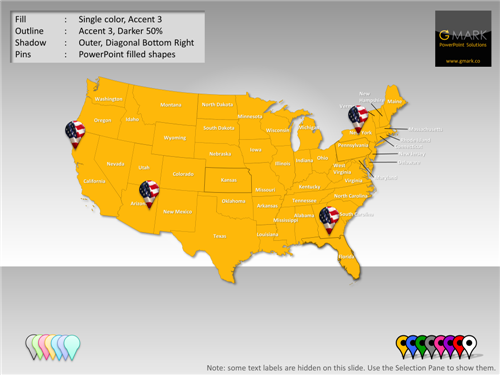
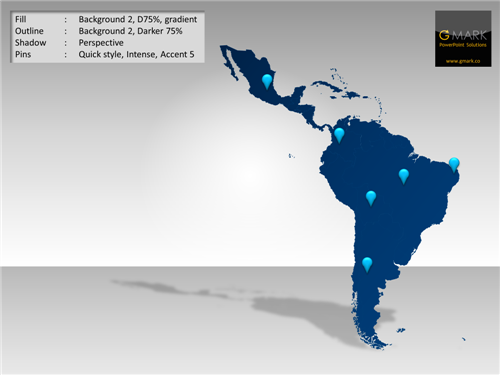
Find the map you want quickly from a library of more than 250 country maps and more than 3000 USA county maps, then insert them directly into your slide and: Edit, delete and add place names; Edit map colors, outlines, fills and effects; Animate place names and countries; - Resize maps without loss of resolution; - Selectable continents, countries and regions by shape name; - Automatically colour multi-shape maps from Excel data. And because all of the maps are PowerPoint shapes, you can even animate them to appear in a certain sequence of make them appear on the click of other objects on your slides. Once you've clicked the Map button, an extensive range of maps with a wide variety of options are available at your finger tips.
What is new in this release:
New Features:
- Extended trial mode
- New regional maps for : Denmark, Norway, Sweden, Finland, France, Germany, China, India, Indonesia, Malaysia, Myanmar, Sri Lanka, Vietnam.
- Added a new map for "UK Postcode Areas"
- Miller and Robinson projections to the World map series
- Heatmap mode now supports RGB and HSL color spaces and a graphical scale indicator
- Added support to be able to add maps to slide masters and custom layouts.
- French installer
- The PowerPoint Selection Pane is now automatically activated and width scaled to the named slide content when a map is inserted and a help tip message is displayed.
- The map group (layer) is now automatically selected when a map is inserted to aid the use of the Auto Color feature.
- If numerous map elements are not found in an Auto Color operation, the user is asked if vMaps should try to select the map group (layer).
What is new in version 1.4:
New Features: - Map library now includes the African countries of Sudan, South Sudan and Malawi. - New Australia outline map in Mercator projection. - New Australia States map with state and major city labels. - Auto Color Excel template updated with changes for Africa and new sheets for Ireland. - New trial functionality to enable evaluation of Auto Color feature. - Licensing for double-byte languages. - Auto check for updates when PowerPoint starts (with user override). - Trial reminder appears when PowerPoint starts. - Map window unloads after a map has been inserted. Bug Fixes: - USA states (48) map error fixed for the states of New Jersey / New York. - Tasmania now part of the Australia grouping. - Bug fixed whereby incorrect map name text could be added to slide. - Compatibility issues with PowerPoint x64 (2010 & 2013 on Win 7/8 x64) have been fixed. - Corrected a bug that caused the add-in to crash when trying to fill shape groups that contain non-freeform shapes. - Auto Color now works if map is filled with a picture (e.g. a flag) before Auto Color starts.
Requirements:
Microsoft PowerPoint 2013, 2010 or 2007
Limitations:
Limited access to a few specific country maps


Comments not found